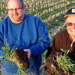
Soil Conservation in New Zealand and the United States
This paper explores former SCS director Donald A. Williams' review of and suggestions for improving New Zealand's soil conservation institutions in 1964.
Soil Data Viewer is a tool built as an extension to ArcMap that allows a user to create soil-based thematic maps.
Download the Soil Data Viewer 5.0 installation package for non-USDA Common Computing Environment (CCE) platforms. The non-USDA CCE audience includes, but is not limited to, cooperators, consultants, educational institutions, technical service providers, and the general public.
Download the Soil Data Viewer 5.1 installation package for non-USDA Common Computing Environment (CCE) platforms. The non-USDA CCE audience includes, but is not limited to, cooperators, consultants, educational institutions, technical service providers, and the general public.
Download the Soil Data Viewer 5.2 installation package for non-USDA Common Computing Environment (CCE) platforms. The non-USDA CCE audience includes, but is not limited to, cooperators, consultants, educational institutions, technical service providers, and the general public.
Download Soil Data Viewer 6.0 for non-USDA Common Computing Environment (CCE) platforms. The non-USDA CCE audience includes, but is not limited to, cooperators, consultants, educational institutions, technical service providers, and the general public.
Download Soil Data Viewer 6.1 for non-USDA Common Computing Environment (CCE) platforms. The non-USDA CCE audience includes, but is not limited to, cooperators, consultants, educational institutions, technical service providers, and the general public.
This page allows you to download Soil Data Viewer 6.2 for non-USDA Common Computing Environment (CCE) platforms. The non-USDA CCE audience includes, but is not limited to, cooperators, consultants, educational institutions, technical service providers, and the general public.
Caribbean soil survey interpretations predict soil behavior for specified soil uses and under specified soil management practices.
A national map product that provides a consistent set of spatially continuous soil property maps to support large scope soil investigations and land use decisions.
Taxonomic classification reports are accessed using the Soil Series Classification Database (SC).
The Soil Survey Geographic Database (SSURGO) contains information about soil as collected by the National Cooperative Soil Survey over the course of a century. The information was gathered by walking over the land and observing the soil. Many soil samples were analyzed in laboratories.
The Iowa NRCS Soils Program provides quality soil, geographic, and resources information, products, and services to internal and external customers.
SSURGO Portal (Beta) imports SSURGO data into geospatial SQLite SSURGO Template databases, generates raster versions of soil map units, and contains the Soil Data Viewer tool, which creates tables of soil properties and interpretations that can be used to create thematic maps in GIS.
This page contains statewide New Hampshire soils information for soils professionals, students and researchers.
This history provides a window onto SCS’ and later NRCS’s delivery of assistance to land owners, and how new legislation and programs influenced the conservation operations.
Technical Soil Services are a function of the USDA-NRCS, under the Soil and Plant Science Division and the National Cooperative Soil Survey (NCSS). TSS are also performed by soil scientists of the U.S. Department of the Interior, Bureau of Land Management, and the Forest Service as part of the NCSS.